


Voting District 24, Randolph County, North Carolina
About
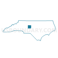
Outline

Summary
| Unique Area Identifier | 641202 |
| Name | Voting District 24 |
| County | Randolph County |
| State | North Carolina |
| Area (square miles) | 50.75 |
| Land Area (square miles) | 50.68 |
| Water Area (square miles) | 0.07 |
| % of Land Area | 99.86 |
| % of Water Area | 0.14 |
| Latitude of the Internal Point | 35.55761320 |
| Longtitude of the Internal Point | -80.00377790 |
Maps


Graphs
Select a template below for downloading or customizing gragh for Voting District 24, Randolph County, North Carolina


Neighbors
Neighoring Voting District (by Name) Neighboring Voting District on the Map
- Voting District 16, Randolph County, NC
- Voting District 18, Randolph County, NC
- Voting District 40, Randolph County, NC
- Voting District 56, Davidson County, NC
- Voting District ELD, Montgomery County, NC
- Voting District OPH, Montgomery County, NC
Top 10 Neighboring County Subdivision (by Population) Neighboring County Subdivision on the Map
- Cedar Grove township, Randolph County, NC (8,947)
- Union township, Randolph County, NC (2,940)
- Concord township, Randolph County, NC (2,613)
- Eldorado township, Montgomery County, NC (1,873)
- New Hope township, Randolph County, NC (1,198)
- Jackson Hill township, Davidson County, NC (1,107)
- Alleghany township, Davidson County, NC (710)
- Ophir township, Montgomery County, NC (641)
Top 10 Neighboring Unified School District (by Population) Neighboring Unified School District on the Map
- Davidson County Schools, NC (127,662)
- Randolph County Schools, NC (113,222)
- Montgomery County Schools, NC (27,798)
Top 10 Neighboring State Legislative District Lower Chamber (by Population) Neighboring State Legislative District Lower Chamber on the Map
- State House District 80, NC (78,723)
- State House District 67, NC (75,179)
- State House District 66, NC (70,881)
- State House District 78, NC (69,360)
Top 10 Neighboring State Legislative District Upper Chamber (by Population) Neighboring State Legislative District Upper Chamber on the Map
Top 10 Neighboring 111th Congressional District (by Population) Neighboring 111th Congressional District on the Map
Top 10 Neighboring Census Tract (by Population) Neighboring Census Tract on the Map
- Census Tract 307, Randolph County, NC (6,011)
- Census Tract 620.01, Davidson County, NC (4,677)
- Census Tract 620.02, Davidson County, NC (4,021)
- Census Tract 9603, Montgomery County, NC (3,914)